Total solar eclipse of April 8, 2024 over Mexico, the USA, and Canada
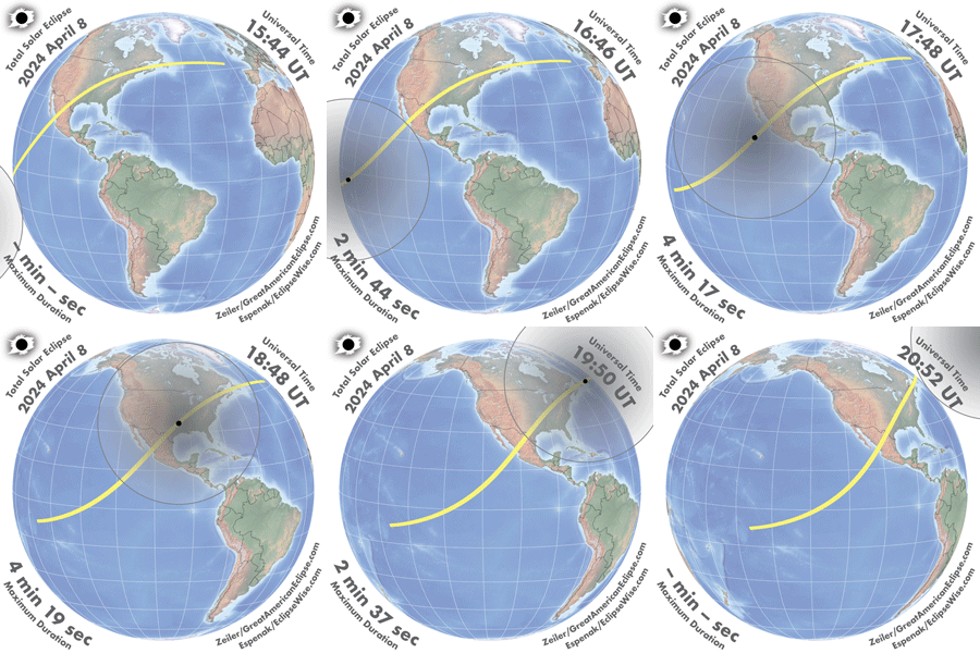
Watch the Moon’s shadow fly from Mazatlan to Newfoundland on April 8, 2024! This animation simulates the view from a spacecraft 100 miles high that is chasing the eclipse. The dark oval represents where the total solar eclipse will be seen at that moment. The time of eclipse is given in the local time zone. The duration is the maximum at the center of the Moon's shadow. Places near the centerline receive the longest duration.
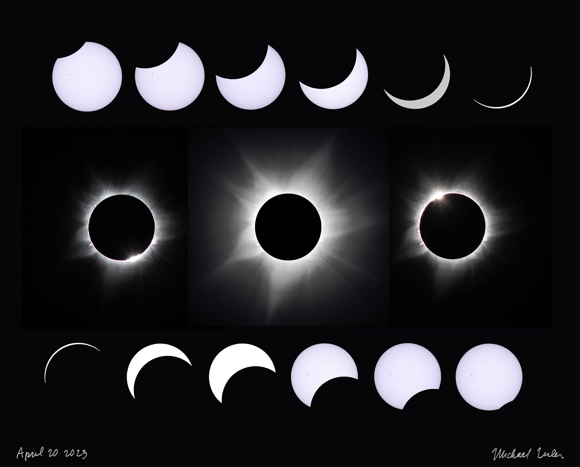
These are the stages of a total solar eclipse. The partial phases last about an hour and 20 minutes.
The next total solar eclipse to visit North America will be April 8, 2024. The duration of totality will be up to 4 minutes and 27 seconds, almost double that of The Great American Eclipse of August 21, 2017. The 2017 total solar eclipse was witnessed by about 20 million people from Oregon to South Carolina, and the upcoming 2024 Great American Eclipse is sure to be witnessed by many millions more.
Because of what they saw — the exquisite beauty of the Sun’s corona hanging in the suddenly darkened sky — many millions more will know that a total solar eclipse is something truly worth seeing. In the US, totality will begin in Texas at 1:27 pm CDT and will end in Maine at 3:35 pm EDT on April 8, 2024. Our GIF below, books, maps, and our new mobile app, show exact times and durations in many locations along the path of totality.
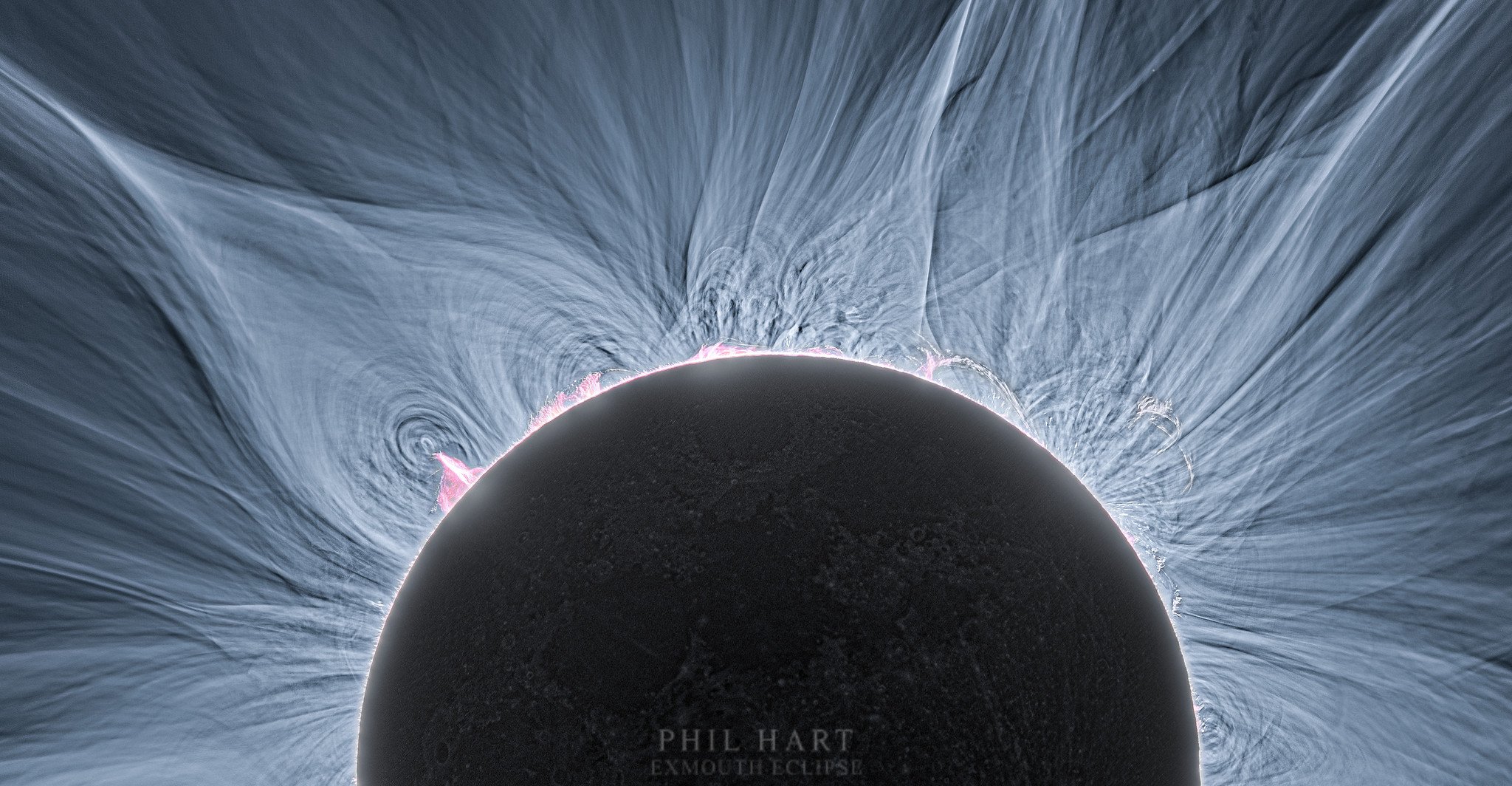
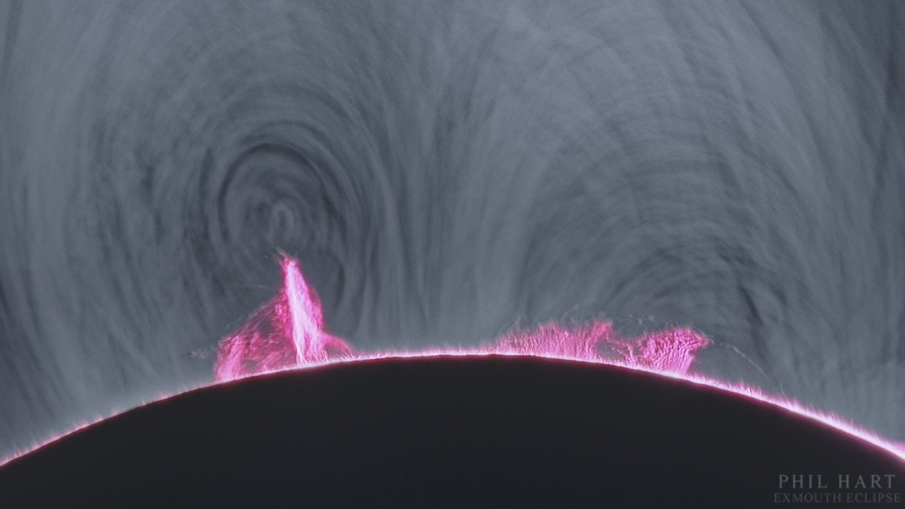
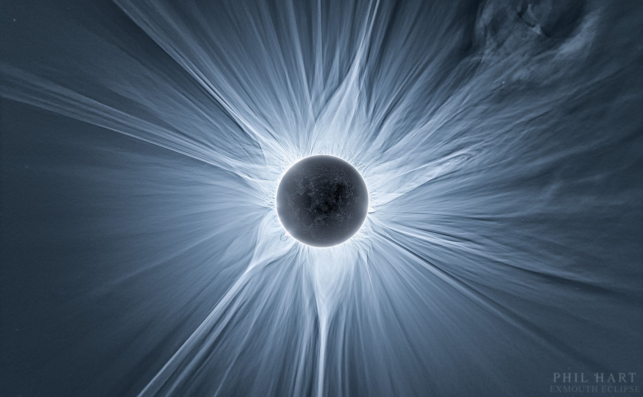
These images from the April 20, 2023 total solar eclipse from Exmouth, Australia are kindly provided by Phil Hart. They provide a preview of what you might see on April 8 as the Sun is near the maximum of its 11-year sunspot cycle. More at philhart.com
If you’ve never seen a total solar eclipse before, put it on your bucket list and mark the date. It is truly a breath-taking sight. You won’t regret traveling to see the Sun’s corona, while you stand in the shadow of the moon!
The Moon’s Shadow
This animated GIF shows the Moon’s shadow arcing across the Pacific, then traversing North America, and ending at sunset not far from Spain. The very longest duration will be near Torreon, Mexico at 4 minutes and 27 seconds.
The inner black circle, the umbra, is where the shadow is complete — a total eclipse of the Sun. The outer shadow circle, the penumbra, shows the extent of the partial eclipse. The partial eclipse will be slight near the outer circle and deep near the path of totality. In a deep partial eclipse, the sky will cool and sunlight will take on an eerie quality. We encourage you get inside the path of totality! 99% is not the same as 100%. You will only see the corona when you are at 100% eclipse; inside the path of totality.
Map of Totality
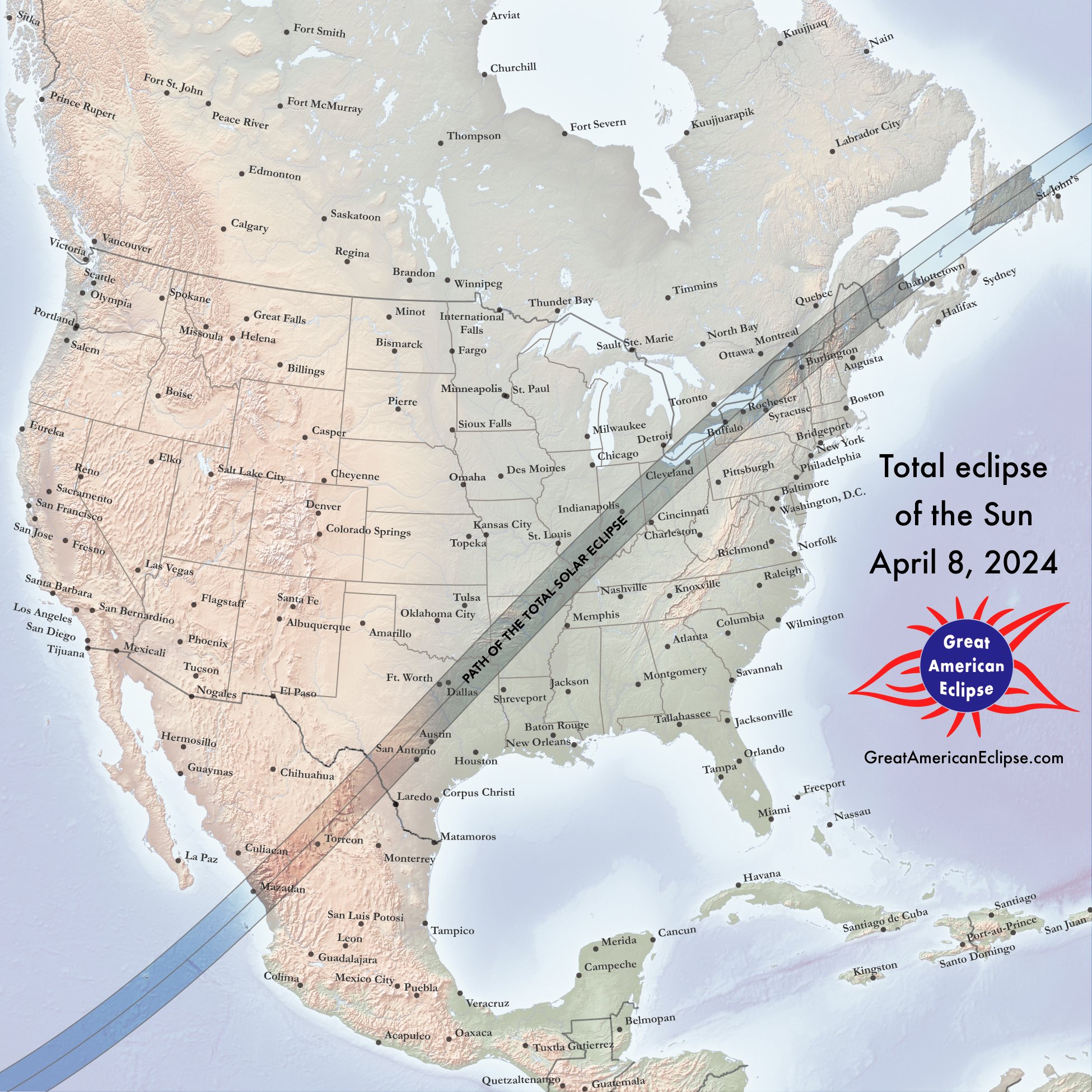
This map of the April 8, 2024 total solar eclipse shows durations of totality, what time greatest eclipse is, the degree of partial eclipse outside the path of totality, and the major cities of North America. Use this to find your best location for nature’s greatest sight.
map of the April 8, 2024 total solar eclipse. You can purchase this map at .greatamericaneclipse.com/maps-and-posters
Totality over the United States
Learn more about the total solar eclipse in each of the states inside the path of totality by clicking the links below.
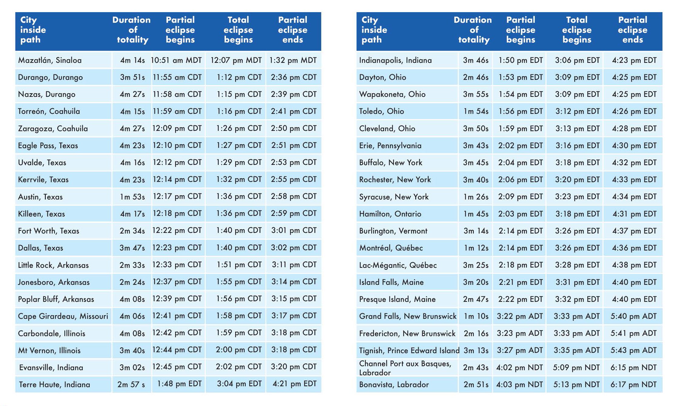
Places inside the path of totality














These are the times and durations of the eclipse at points inside the path of total solar eclipse
Eclipse Impact
How big will the impact of eclipse visitation be to the path of totality? Start with the fact that 31 million people in the United States already live inside the path of totality. These maps summarize the potential visitation from neighboring states, weighing travel distance from throughout the nation.
Safely viewing the eclipse
Solar eclipses can be viewed safely. The rules are simple; use only ISO-certified-safe solar eclipse glasses and viewers, and keep them on while the Sun is not yet fully eclipsed. Once the sky suddenly turns dark, and the solar corona appears, then you can take off your eclipse glasses or viewers to look at the Sun’s amazing corona.
The easiest way to view the partial solar eclipse will be with our ISO-certified-safe eclipse glasses, and SUNoculars, available here. For more instruction on safely viewing the eclipse, visit the American Astronomical Society’s authoritative site, eclipse.aas.org/eye-safety
Cities inside the path of totality
These are the cities inside the path of total solar eclipse. Click for larger version
The moon’s shadow first touches Mexico at Mazatlan. Then it travels northeast through Mexico and enters the United States at Texas, cuts a diagonal all the way across the country to Maine, and then visits the maritime provinces of Canada.
The major cities inside the path are Mazatlan, Torreon, San Antonio, Austin, Dallas, Fort Worth, Indianapolis, Cleveland, Buffalo, Rochester, Syracuse, and Montreal.
The ovals in the map show the shadow of the Moon at five minute intervals. This path is called the path of totality.
Highlights along the 2024 path of totality
A Great North American Solar Eclipse
Anticipation for the April 8, 2024 total solar eclipse will be sky high! Not only are there 32 million people already living within the USA section of the path, but metropolitan areas such as St Louis, Cincinnati, Detroit, Toronto, and Quebec are very close to the path. The major cities of Boston, New York, Philadelphia, Baltimore, and Washington, D.C., are all within 200 miles of the path of totality. So be prepared for the single-biggest mass travel event in the USA.
Landfall at Mexico
The first touchdown of the Moon’s shadow on land is Isla Socorro, 600 km from the Mexican mainland. The total solar eclipse first touches the mainland near Mazatlan, Mexico. Totality here is up to 4 minutes, 20 seconds along the center line. Other large Mexican cities in the path are Torreon and Durango.
Texas cities
By celestial luck, the total solar eclipse will drape the major cities of San Antonio, Austin, Dallas, and Fort Worth. Texas will attract many eclipse chasers because of its superior good weather odds, numerous hotel rooms, and an extensive highway system which is key if a last minute relocation to clear skies is needed.
South central states
After Texas, the Moon’s shadow crosses Hot Springs and Little Rock, Arkansas. The path comes close to St. Louis, so there will be a massive amount of traffic south to the path. Carbondale, Illinois enjoys it’s second total solar eclipse just 7 years after the August 21, 2017 eclipse.
The Midwest
Key cities in the path of total eclipse are Indianapolis, Dayton, Toledo, Cleveland, and Akron. The metropolitan areas close to the path include St Louis, Cincinnati, Detroit, and Pittsburgh. Expect extremely heavy traffic into the path on the early morning of April 8, 2024.
Northeastern United States
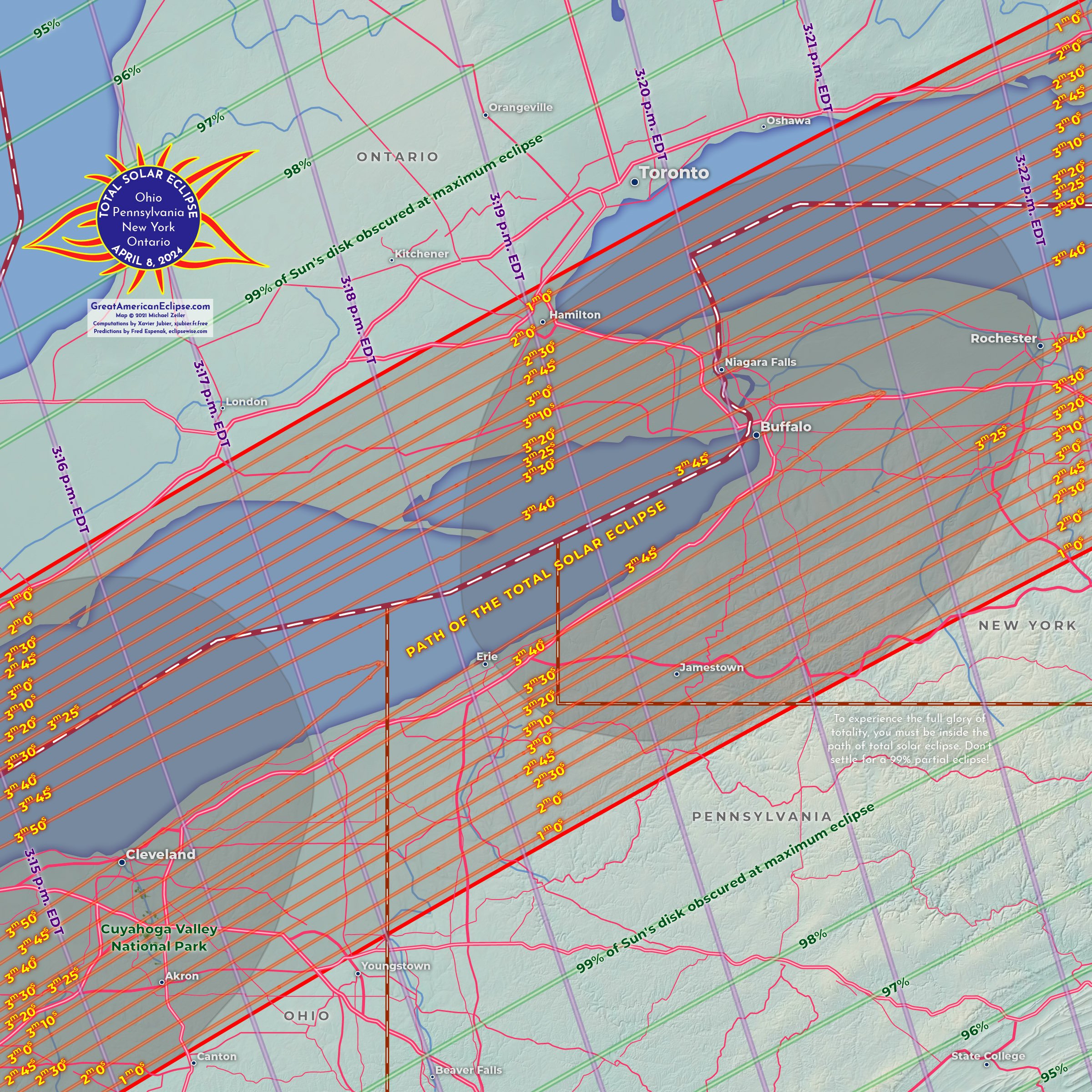
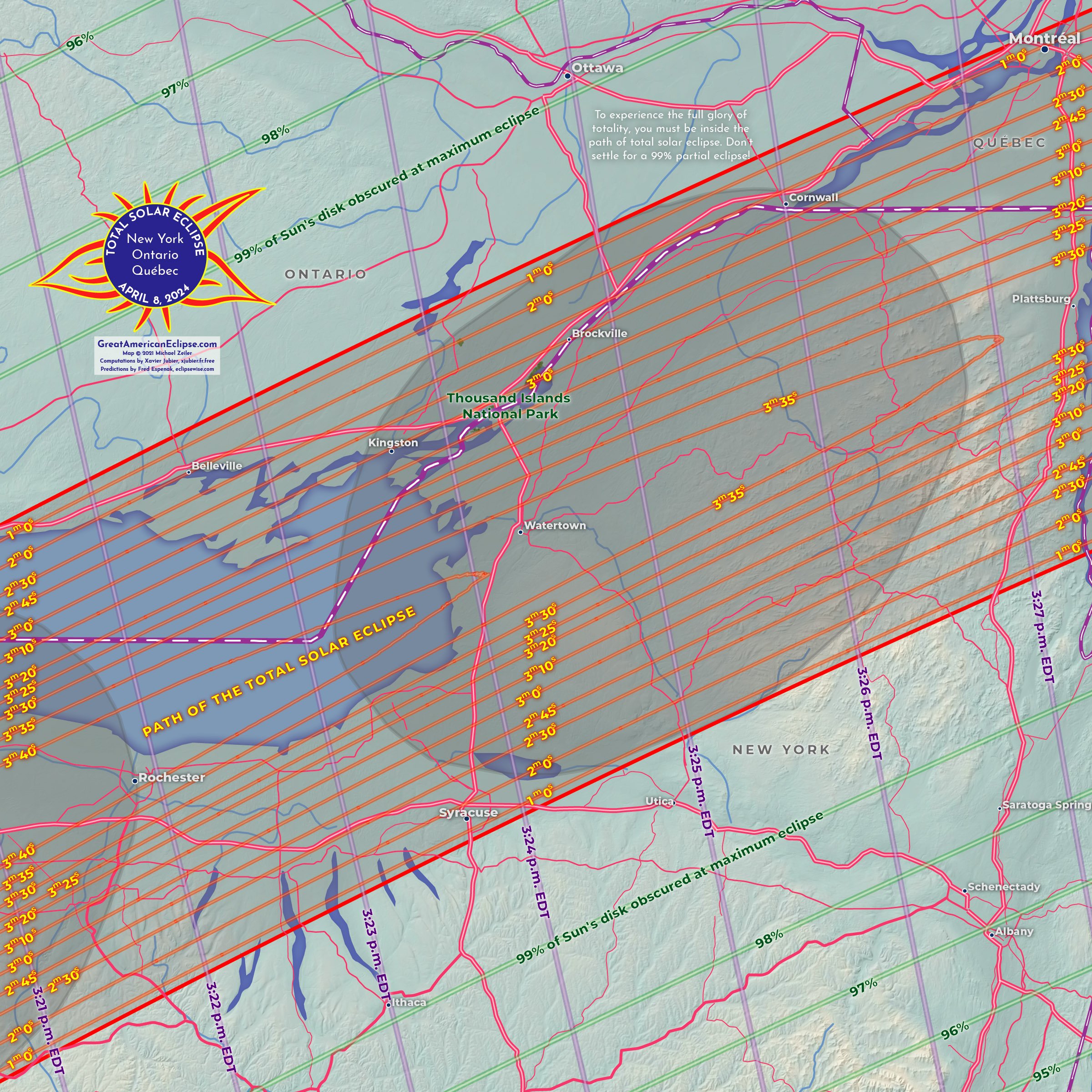
Niagara Falls will be a favored location for many, and a photogenic sight for eclipse landscape photographers. Other cities in the path are Buffalo, Rochester, Syracuse, Burlington, and Presque Island. New York City, Boston, Washington DC, and Philadelphia are within 200 miles of the path of totality! Depending on the weather forecast, there will be a massive number of people leaving the Eastern Seaboard towards the path on the day before and day of eclipse..
Montreal and Canada
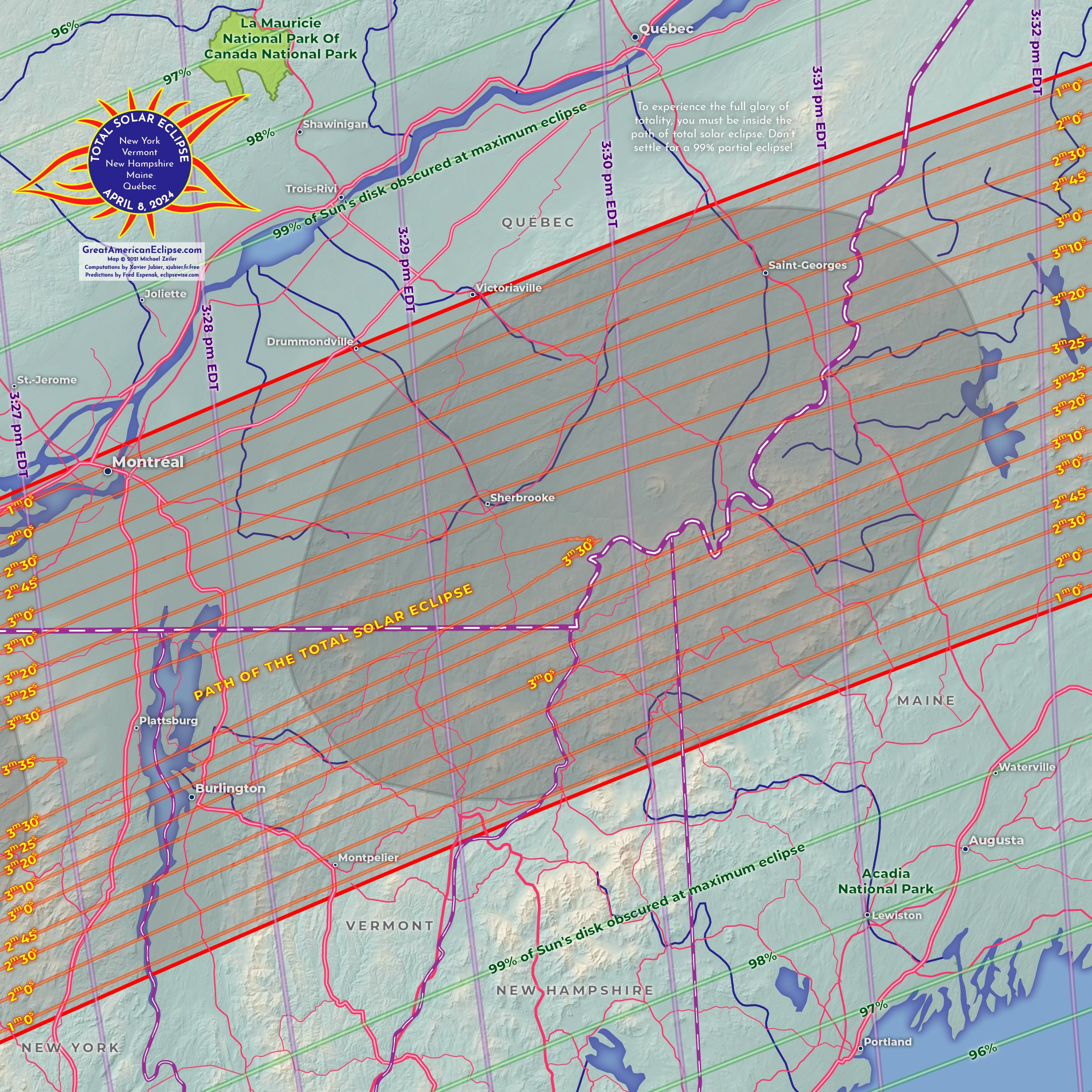
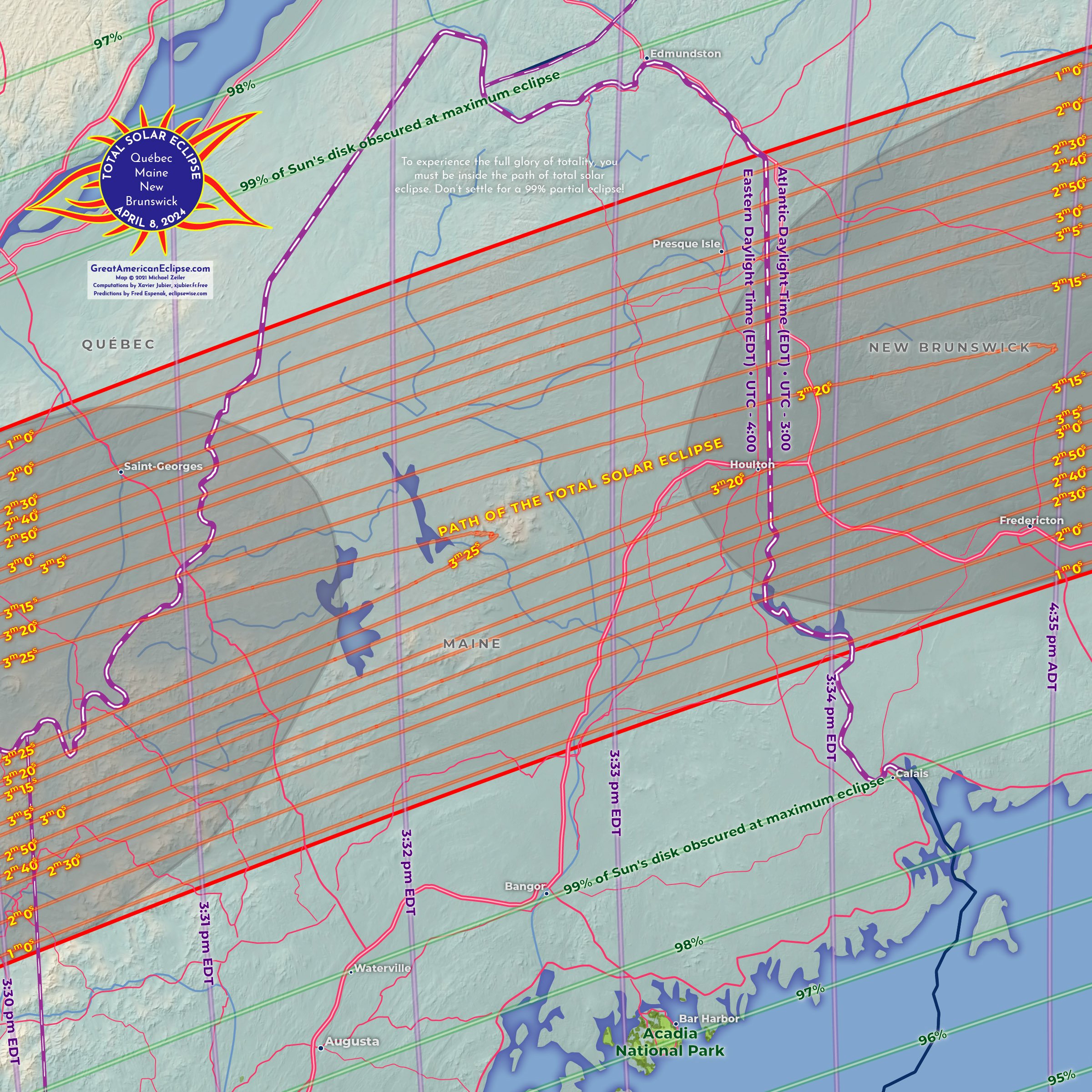
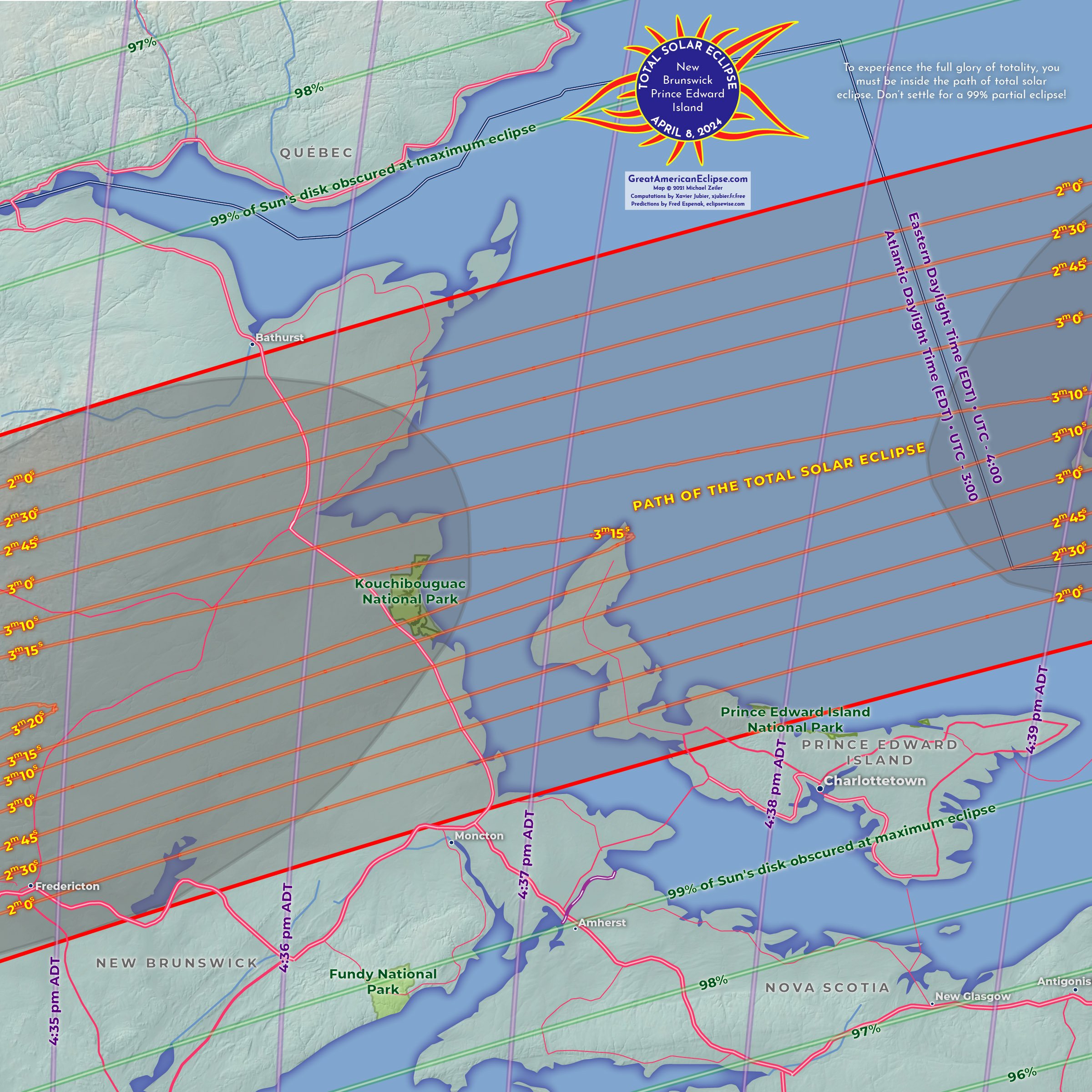
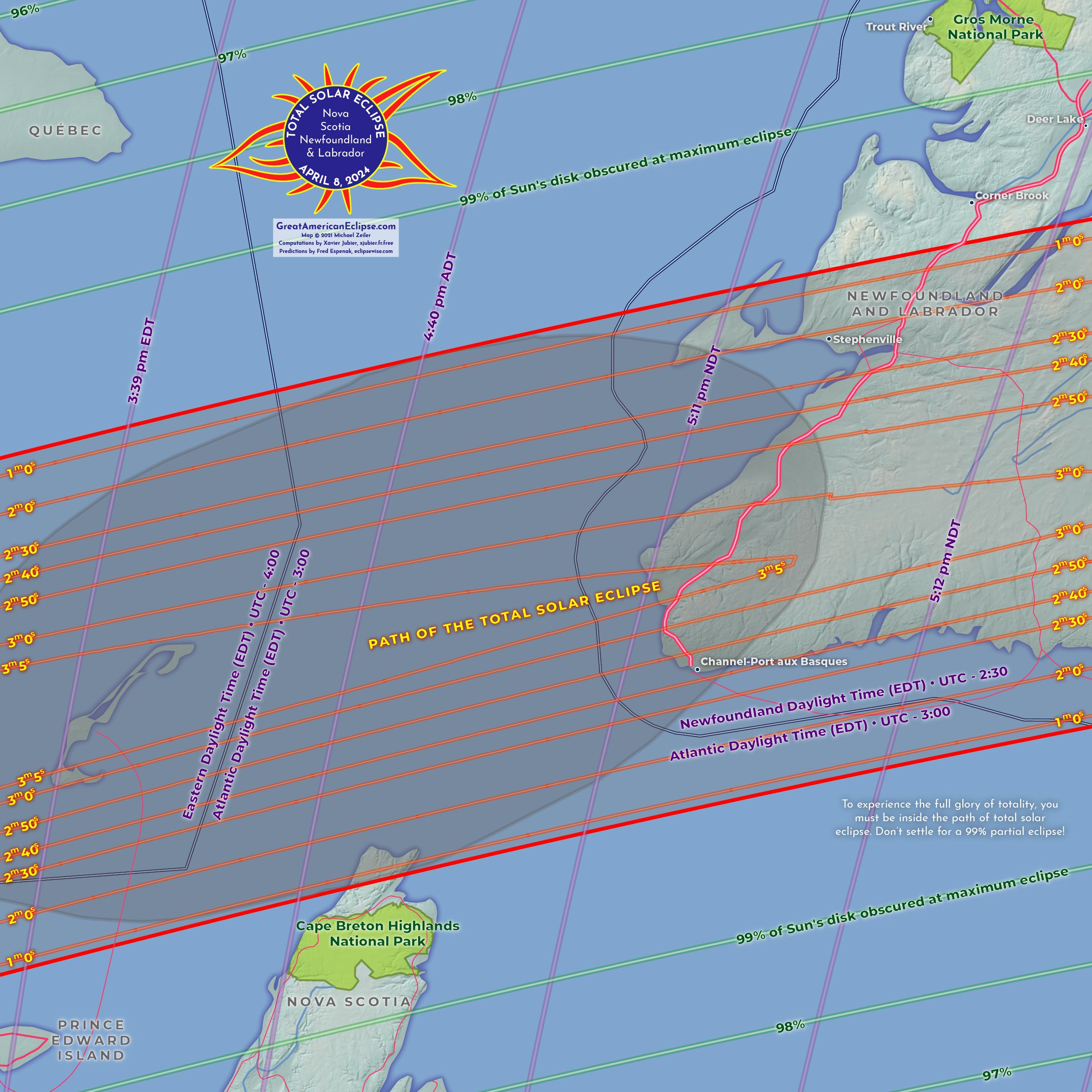
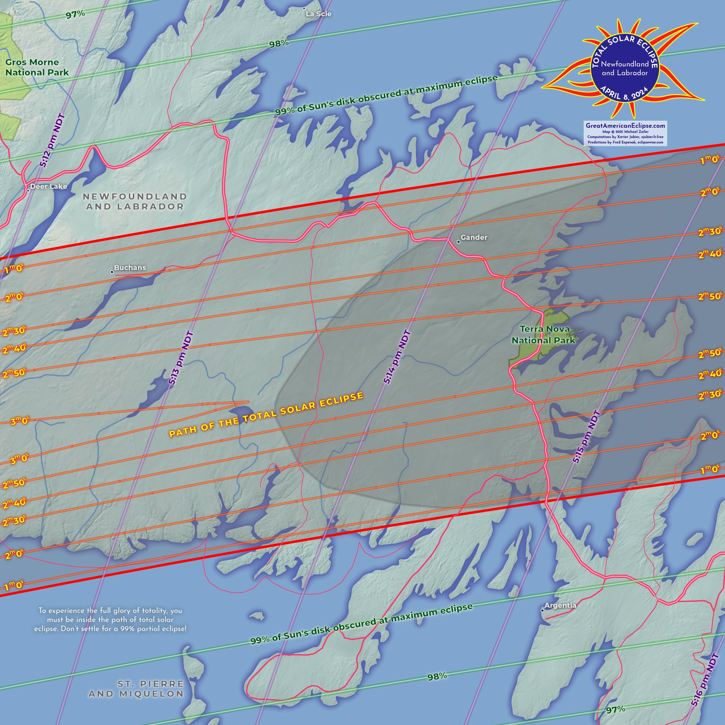
Montreal is inside the path of total solar eclipse and the major Canadian cities of Toronto, Ottawa, and Quebec are within a short drive to the path. After passing parts of the provinces of Ontario and Quebec, the eclipse visits the Maritime Provinces of New Brunswick, Prince Edward Island, Nova Scotia, and Newfoundland and Labrador.
Maps of the eclipse path
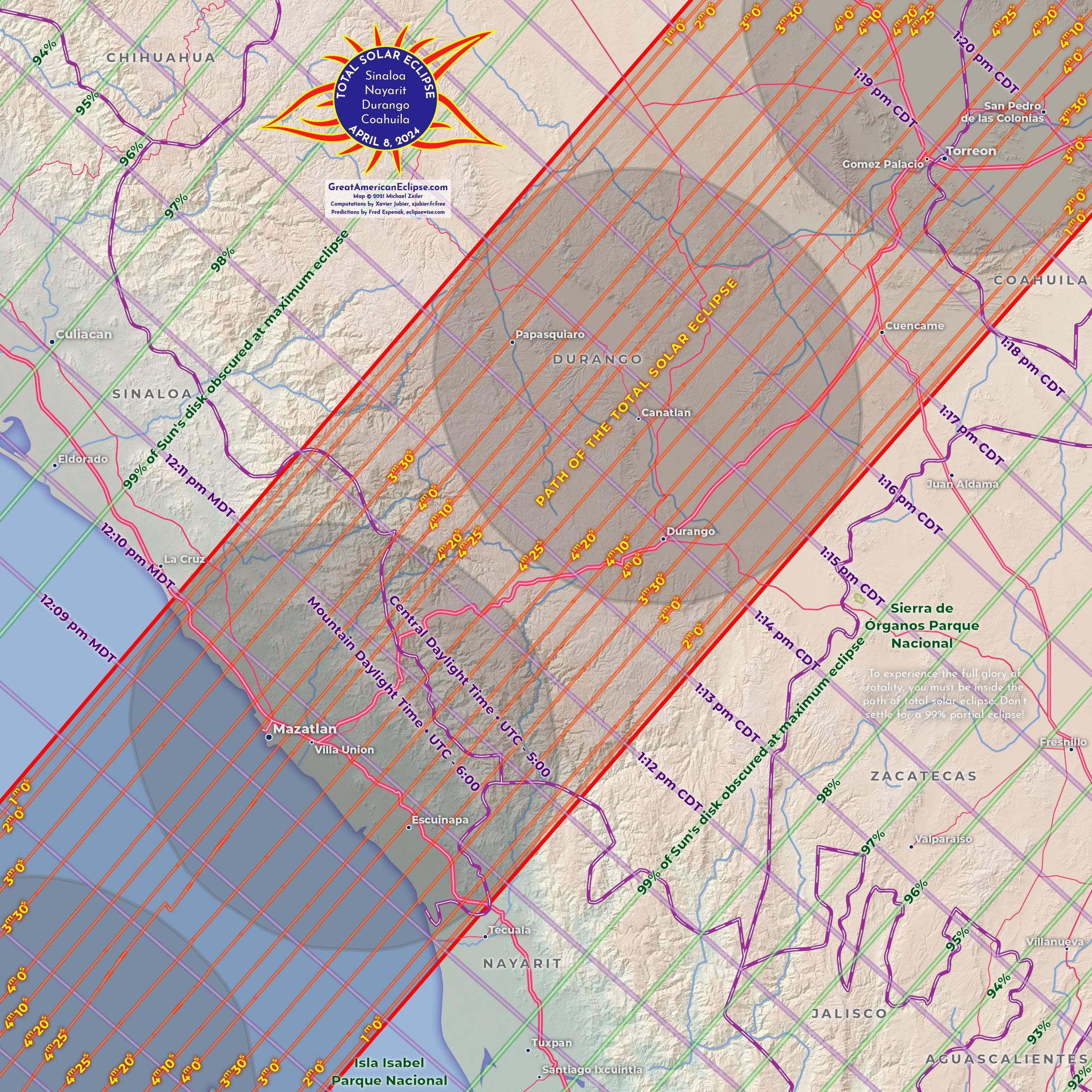
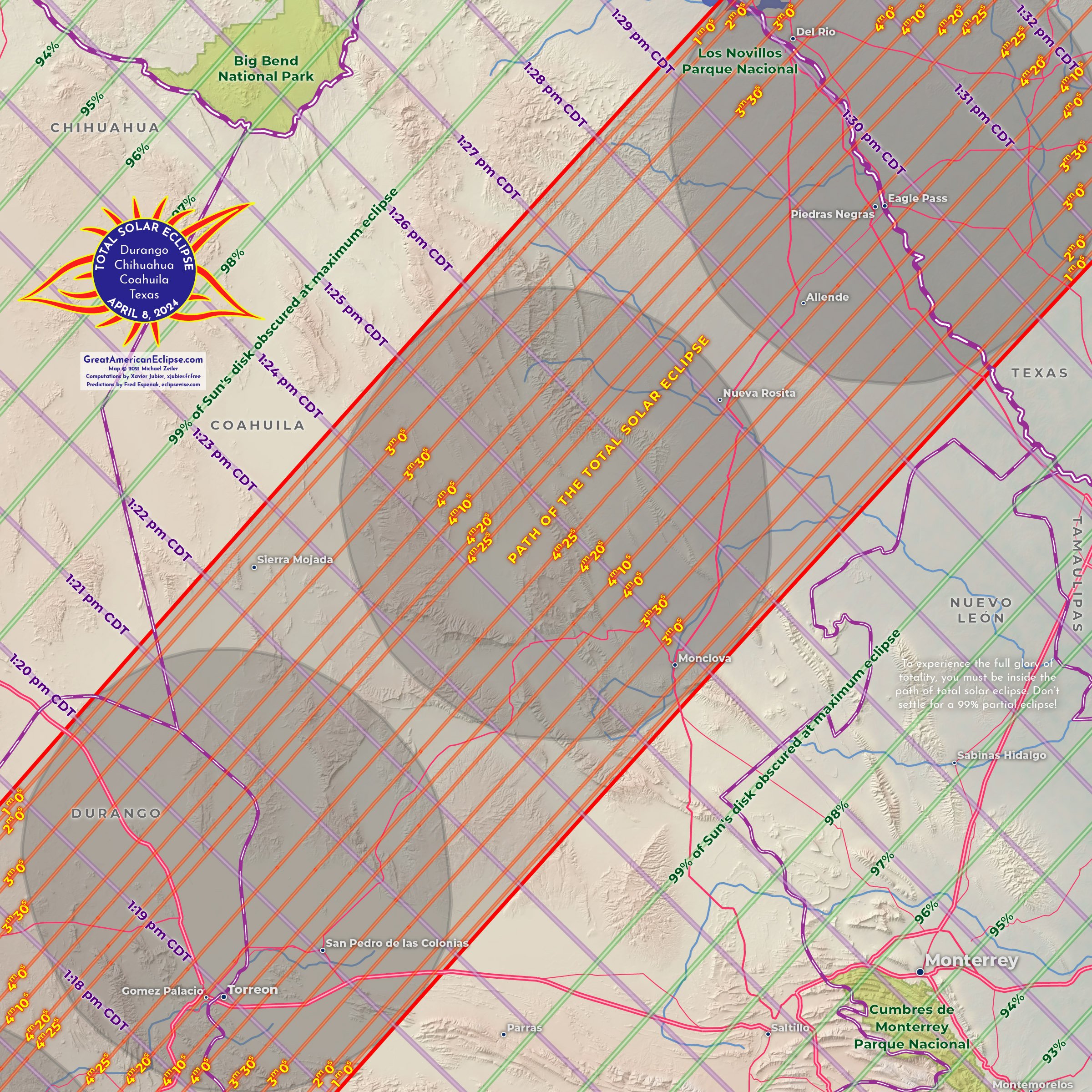
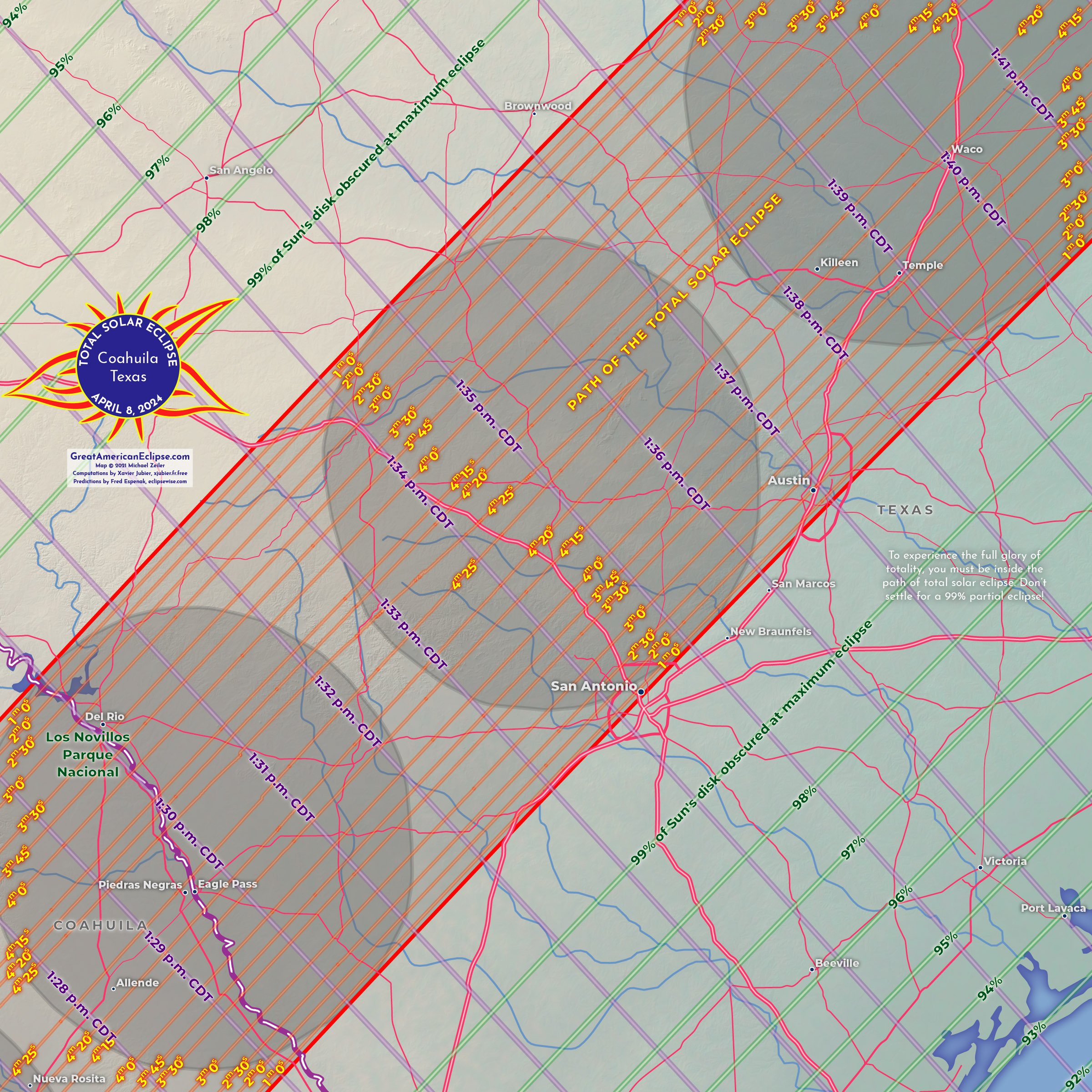
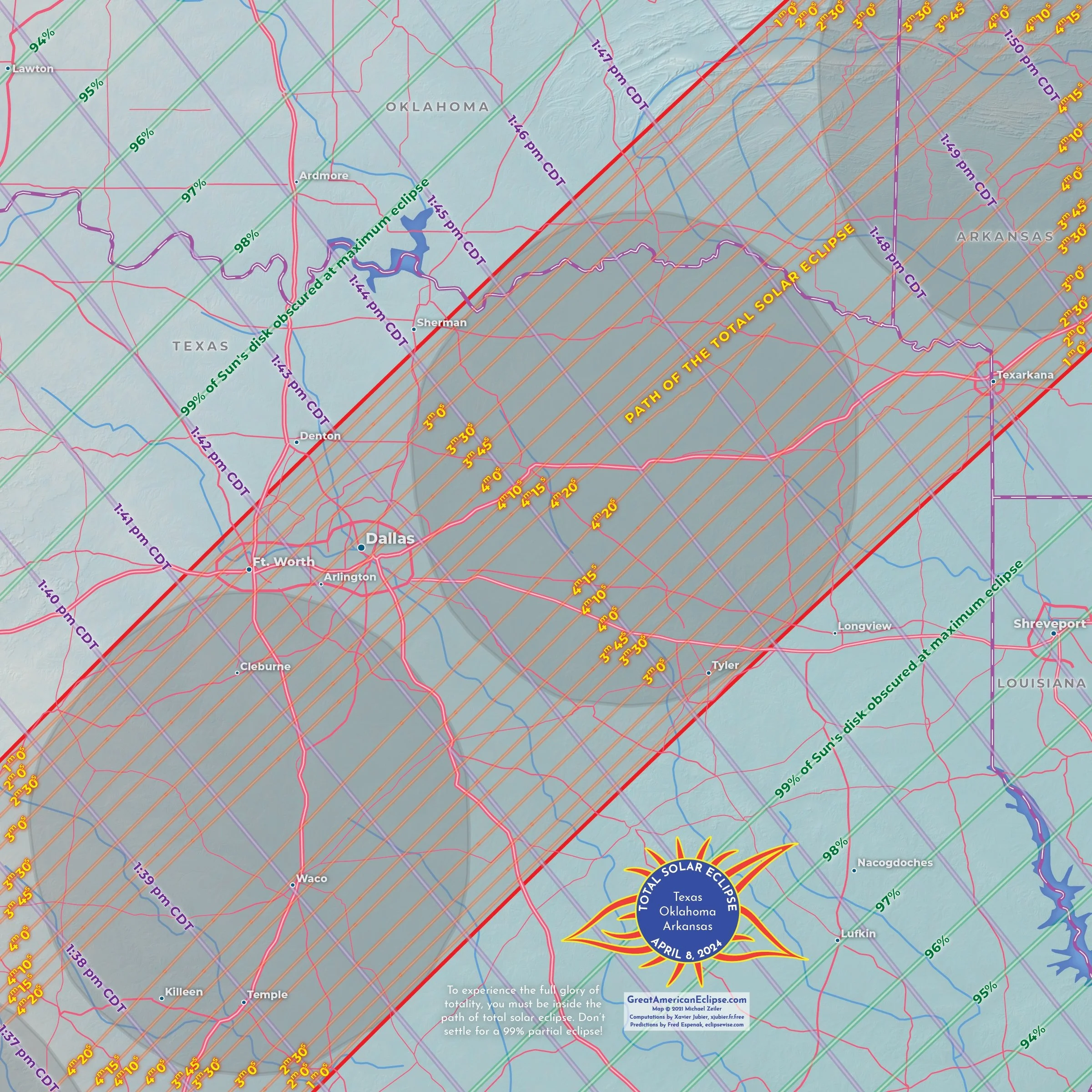
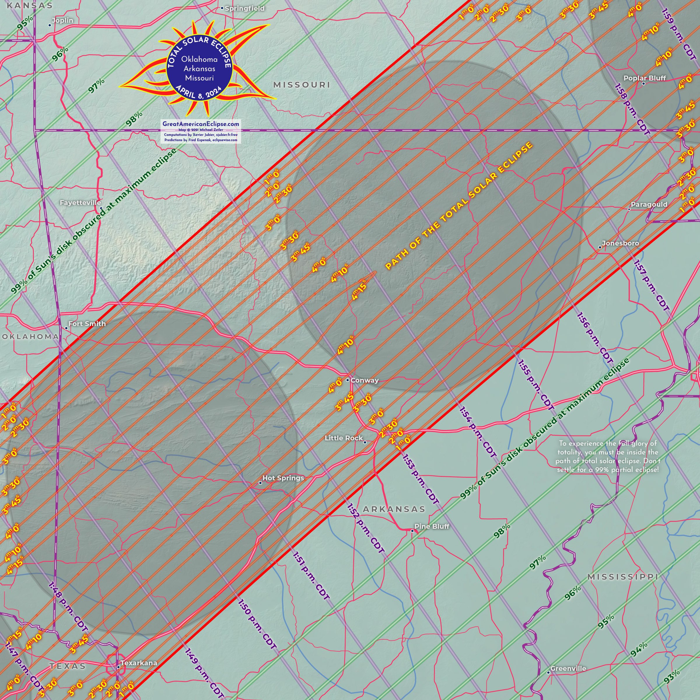
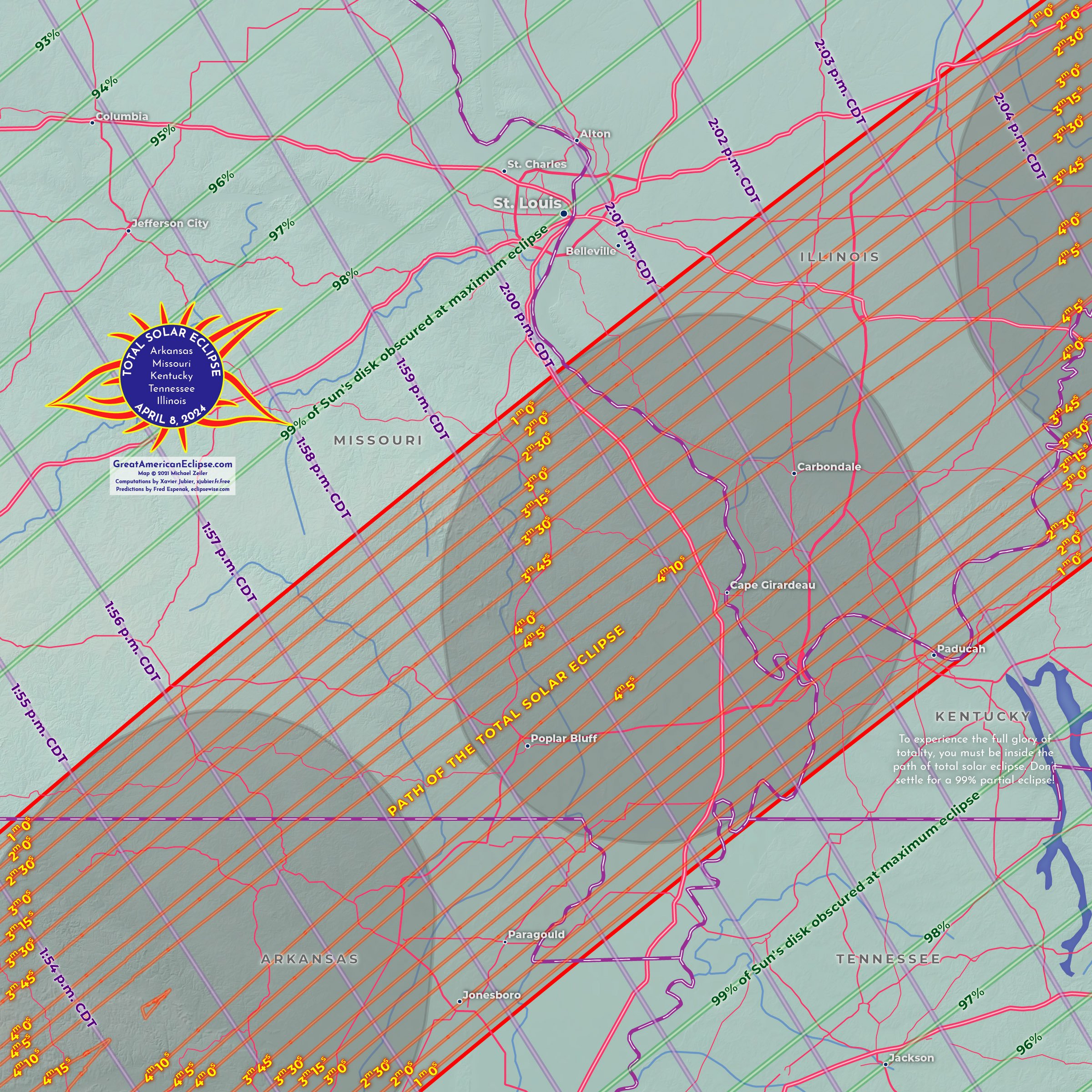
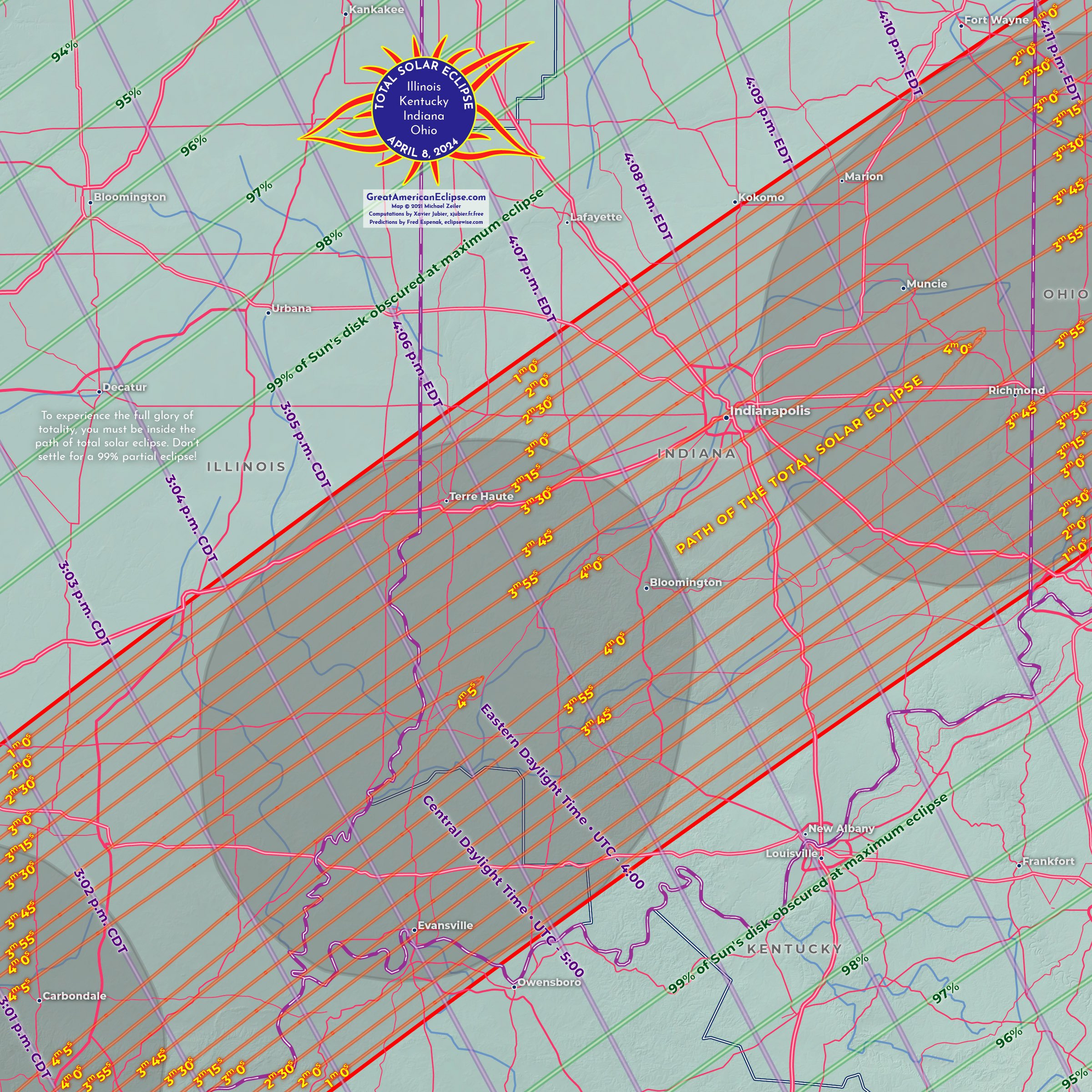
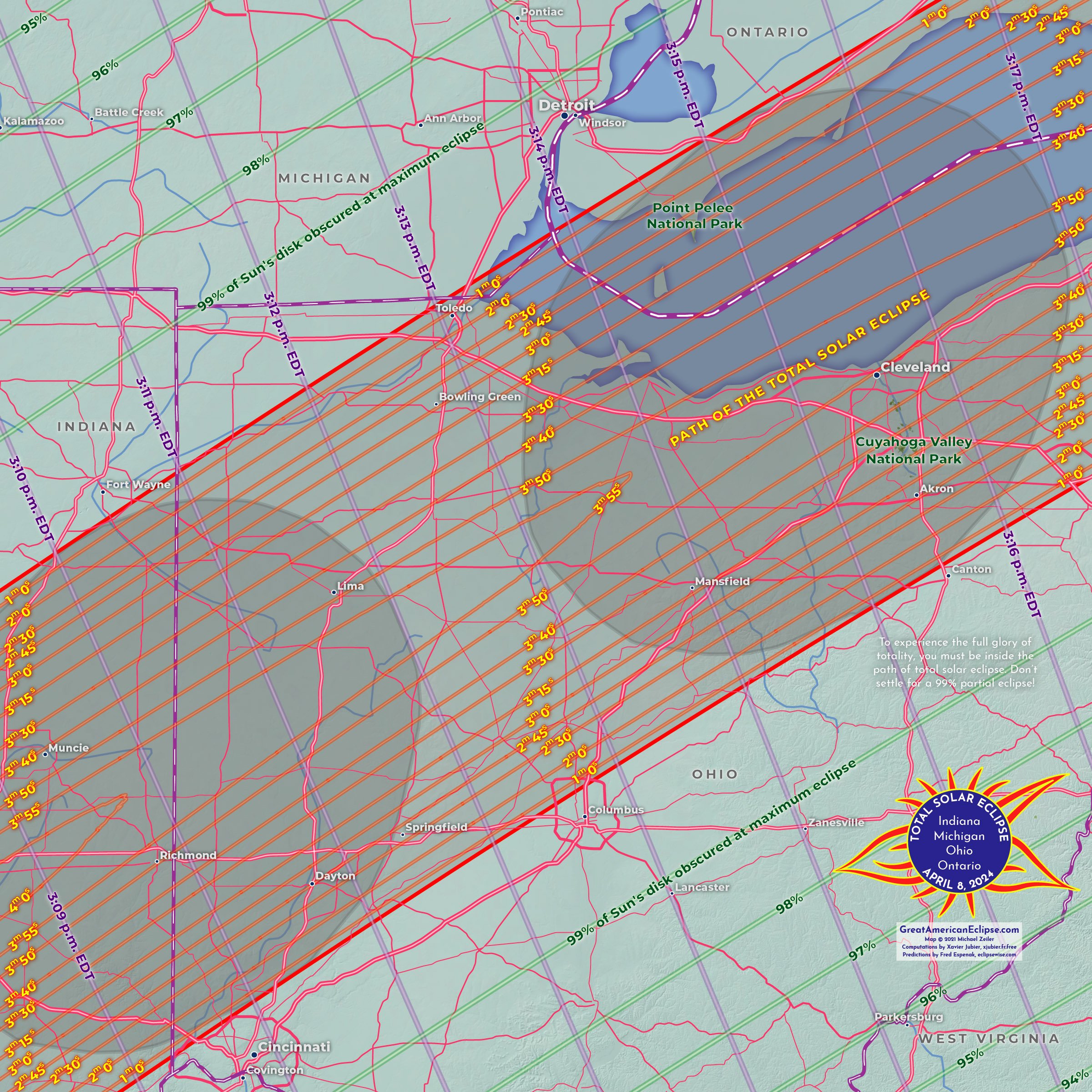
These specific area maps show where to go to see nature’s most amazing sky spectacle. The maps are arranged in the direction that the Moon’s shadow will travel. The gray ovals inside the path are the actual Moon’s shadow, calculated every 5 minutes. Click on each map to see a larger version.
Field Guide to the 2023 and 2024 Solar Eclipses
We recommend our Field Guide for planning your eclipse trip, and also in the lead-up to eclipse day if cloudy weather suggests relocation. Many locations are recommended for a combination of duration, percent chance of clear skies, scenery and culture. By reading the maps, you can look up the start and end times for any location, the duration of totality inside the central path, and the times of greatest eclipse for the partial and total eclipse areas. The Field Guide includes 2 eclipse glasses and is available here.
These maps are from our Atlas of Solar Eclipses - 2020 to 2045 . This atlas spans all partial, annular, hybrid, and total solar eclipses around the globe within 26 years. If you are an eclipse chaser, this is your vacation guide through 2045!
Detailed path of the april 8, 2024 eclipse over mexico and texas. These maps are from our Atlas of Solar Eclipses — 2020 to 2045. Click to enlarge.
Detailed path of the april 8, 2024 total solar eclipse over central states of the US. These maps are from our Atlas of Solar Eclipses — 2020 to 2045. Click to enlarge..
detailed path of the april 8, 2024 total solar eclipse over eastern states of the us. These maps are from our Atlas of Solar Eclipses — 2020 to 2045. Click to enlarge.
detailed path of the april 8, 2024 total solar eclipse over maine and canadian maritime provinces. These maps are from our Atlas of Solar Eclipses — 2020 to 2045. Click to enlarge.
We developed this map for educators and anyone doing eclipse outreach. This map measures 10 feet by 2 feet and is packed with information on the path of total solar eclipse. You can download our 10-foot long 2024 eclipse map here!
